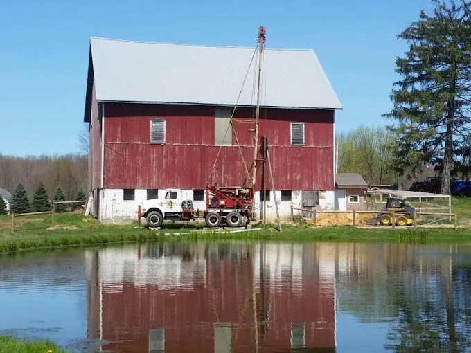
In Columbiana County, rock can sit 5 feet under the surface while water stands 85 feet down: those are the medians near Calcutta, East Liverpool and Wellsville, and they shape how wells there are drilled and pumped.
Rock at 5 feet, water at 85
Near Calcutta, East Liverpool and Wellsville, the logs put the median depth to bedrock at 5 feet and the median water level 85 feet below ground, with median wells of 159 to 165 feet. West Point goes deeper still: 180 feet, the deepest median on the county map, with rock at 8 feet and water at 75. Salineville’s median well is 164 feet, with rock at 9 and water at 76.
A hole like that is nearly all rock, and the pump hangs far below the surface. Yields are modest: 12 gallons a minute at Calcutta and East Liverpool, 10 at Wellsville, 8 at West Point and Salineville. A submersible pump sized to that flow and depth, with a pressure tank to match, is as much of the job as the drilling.
Deeper cover near Homeworth and North Georgetown
Elsewhere the ground changes. Near Homeworth the median depth to bedrock is 63 feet and near North Georgetown 58; Salem’s is 40, and Columbiana, Leetonia and Winona sit at 35. Water stands closer to the surface near Columbiana, a median 33 feet, and Salem, 37. The shallowest median wells are 118 feet at Salem and 120 at several towns, Washingtonville and Winona among them, and the best yields on the map are 18 gallons a minute, near East Rochester and Winona.
The rock mapped at 20 of the 21 town centers is the Allegheny and Pottsville Groups; Calcutta, on the Conemaugh Group, is the exception. Because the picture changes this much from town to town, the closest logs, not the county median, are the guide to a new residential well, and the cost guide explains what sets the price.
Nine towns, three kinds of supply
EPA’s map places 9 of the 21 towns in a public system. Four of those systems pump groundwater: Columbiana City from 11 active wells, Lisbon and New Waterford from 6 each, East Palestine from 5. Three take surface water. East Liverpool draws from the Ohio River, and so does the Buckeye Water District, mapped at Salineville, through two intakes. Salem uses Spring Valley Reservoir, Cold Run Creek and Salem Reservoir, plus 4 wells. Leetonia and Washingtonville buy from Salem.
Wellsville, Calcutta, West Point, Homeworth and the other towns show no system on the map, which is not a finding that no one there has a connection. The USGS county record for well chemistry rests on 14 wells, sampled in 1986 and 2016; the Columbiana County water treatment page takes it one finding at a time.
Source: Water quality: USGS National Water Information System results for Columbiana County wells, served through the Water Quality Portal, sampled between 1986 and 2016, retrieved 2026-09-14. Each well counts once, as the median of its samples. The 0.3 mg/L iron and 0.05 mg/L manganese marks are EPA secondary standards, which are aesthetic limits, not health limits. Well depth: Ohio Department of Natural Resources well-log database, 9,424 domestic wells in Columbiana County with a recorded depth, logged between 1925 and 2026, retrieved 2026-09-14.